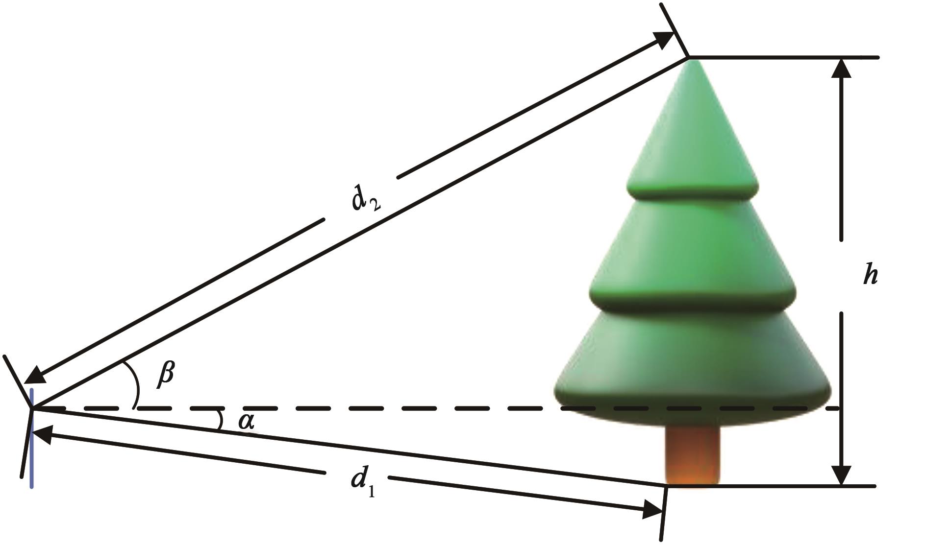
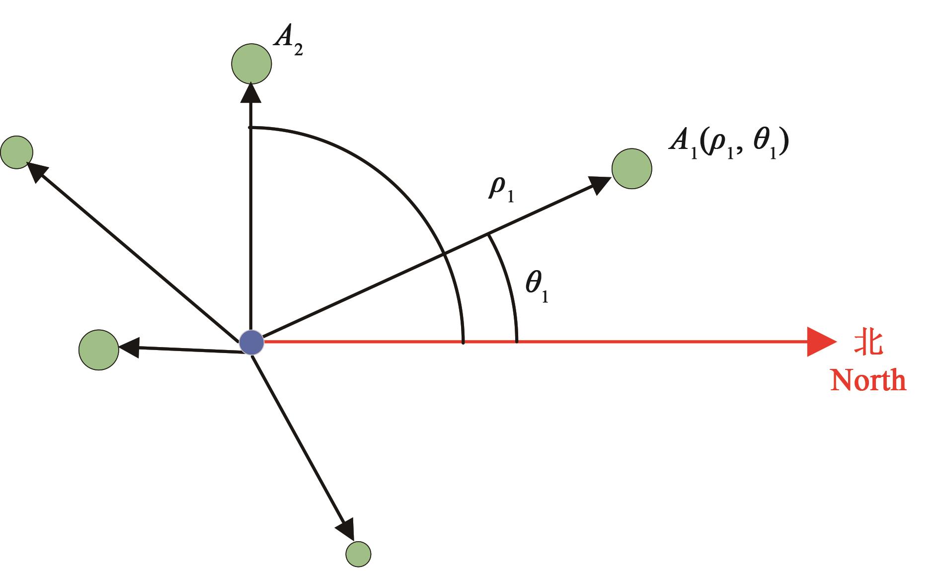
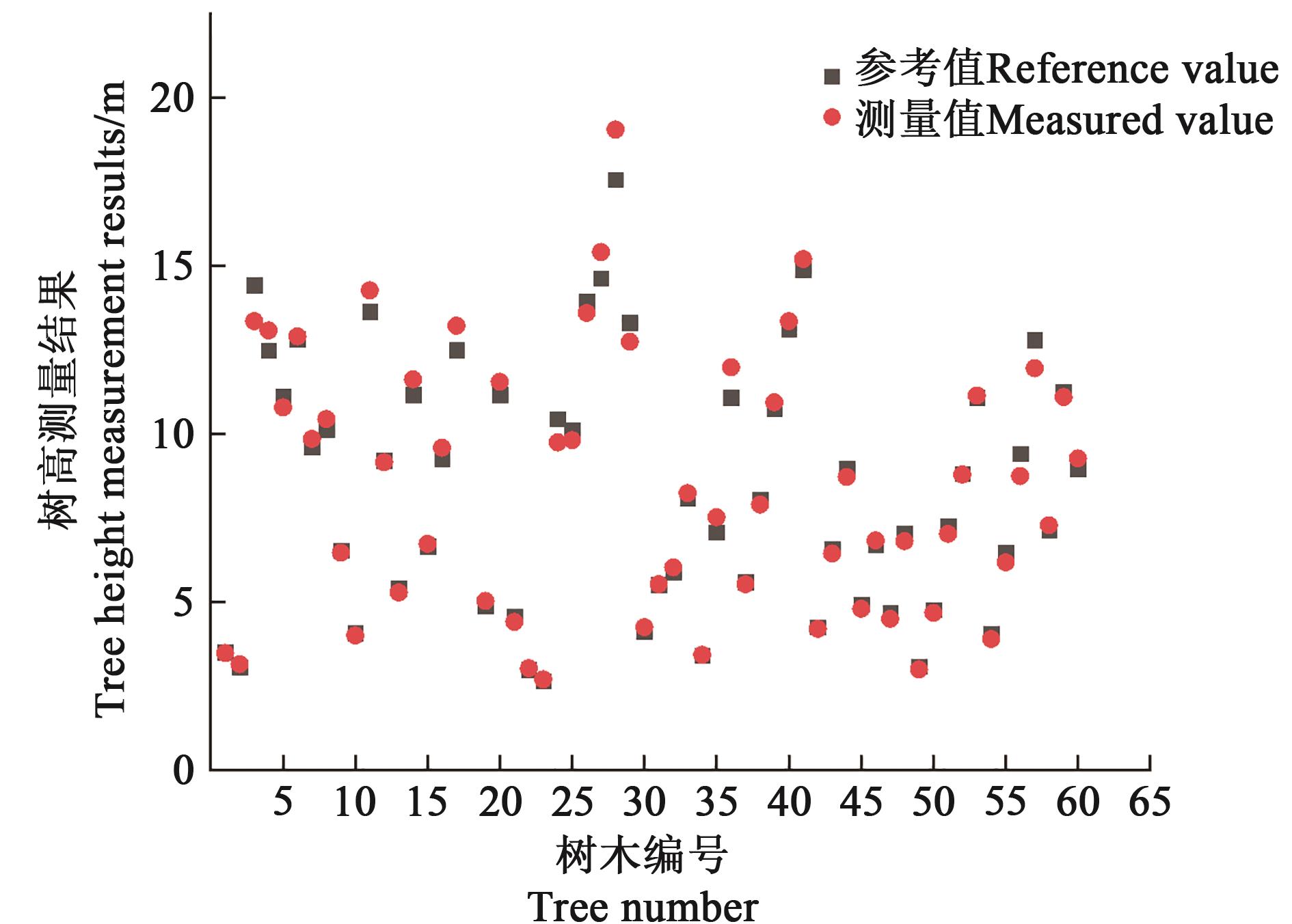
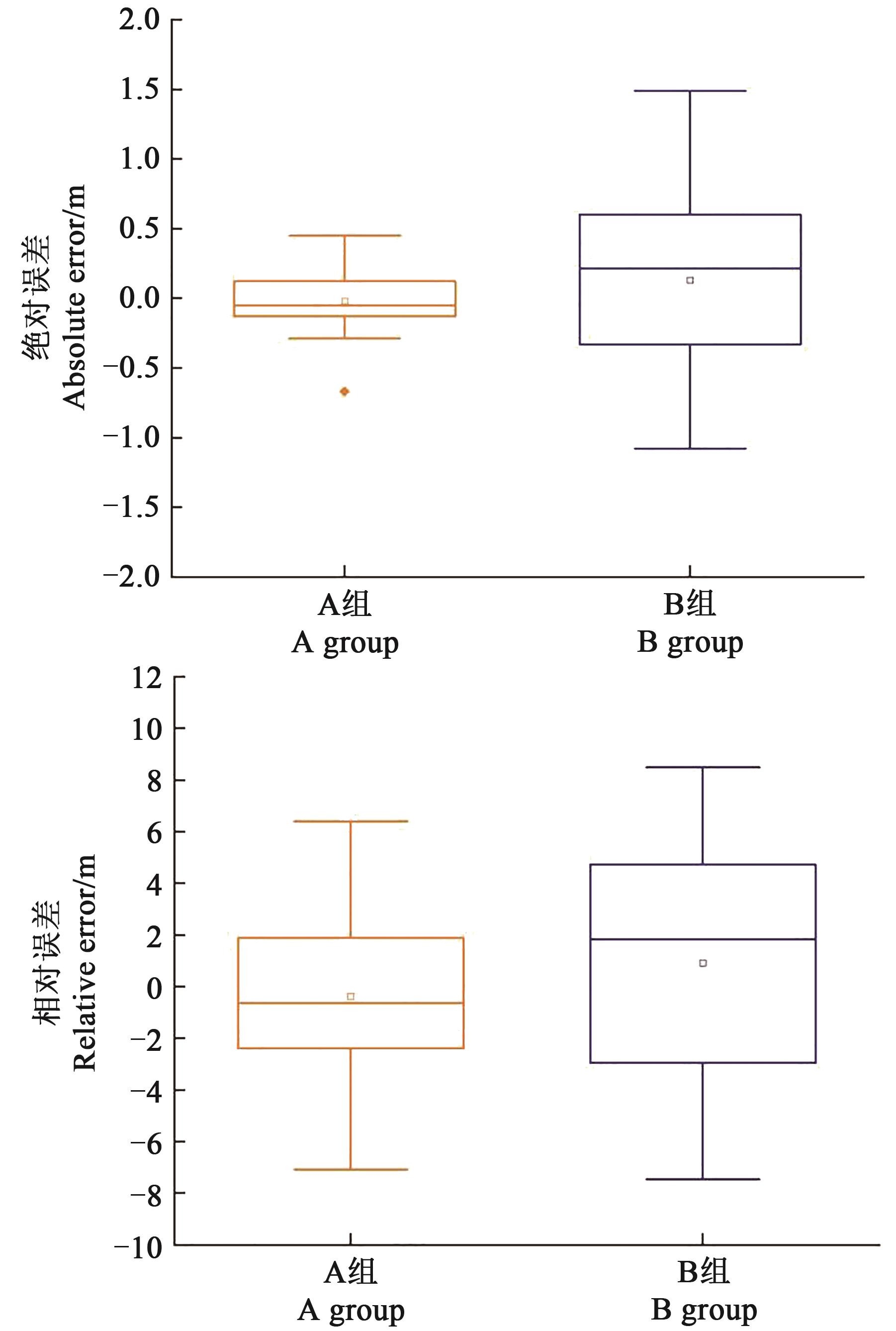
| 1 |
GAUTHIER S, BERNIER P, KUULUVAINEN T, et al.. Boreal forest health and global change [J]. Science, 2015, 349(6250): 819-822.
|
| 2 |
LU J, FENG Z K, ZHU Y. Estimation of forest biomass and carbon storage in China based on forest resources inventory data [J/OL]. Forests, 2019,10(8):650 [2022-10-06]. .
|
| 3 |
刘海洋,冯仲科,呼诺,等.手持式精准立木树高测量仪器设计与试验[J].农业机械学报,2018,49(12):129-134.
|
|
LIU H Y, FENG Z K, HU N, et al.. Design of handheld precis ion standing tree height measurement device [J]. Trans. Chin. Soc. Agric. Mach.,2018,49(12):129-134.
|
| 4 |
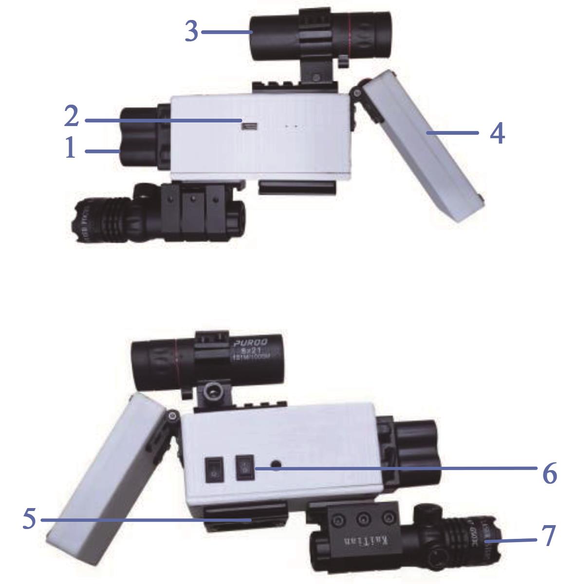
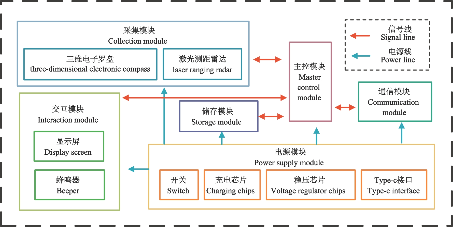
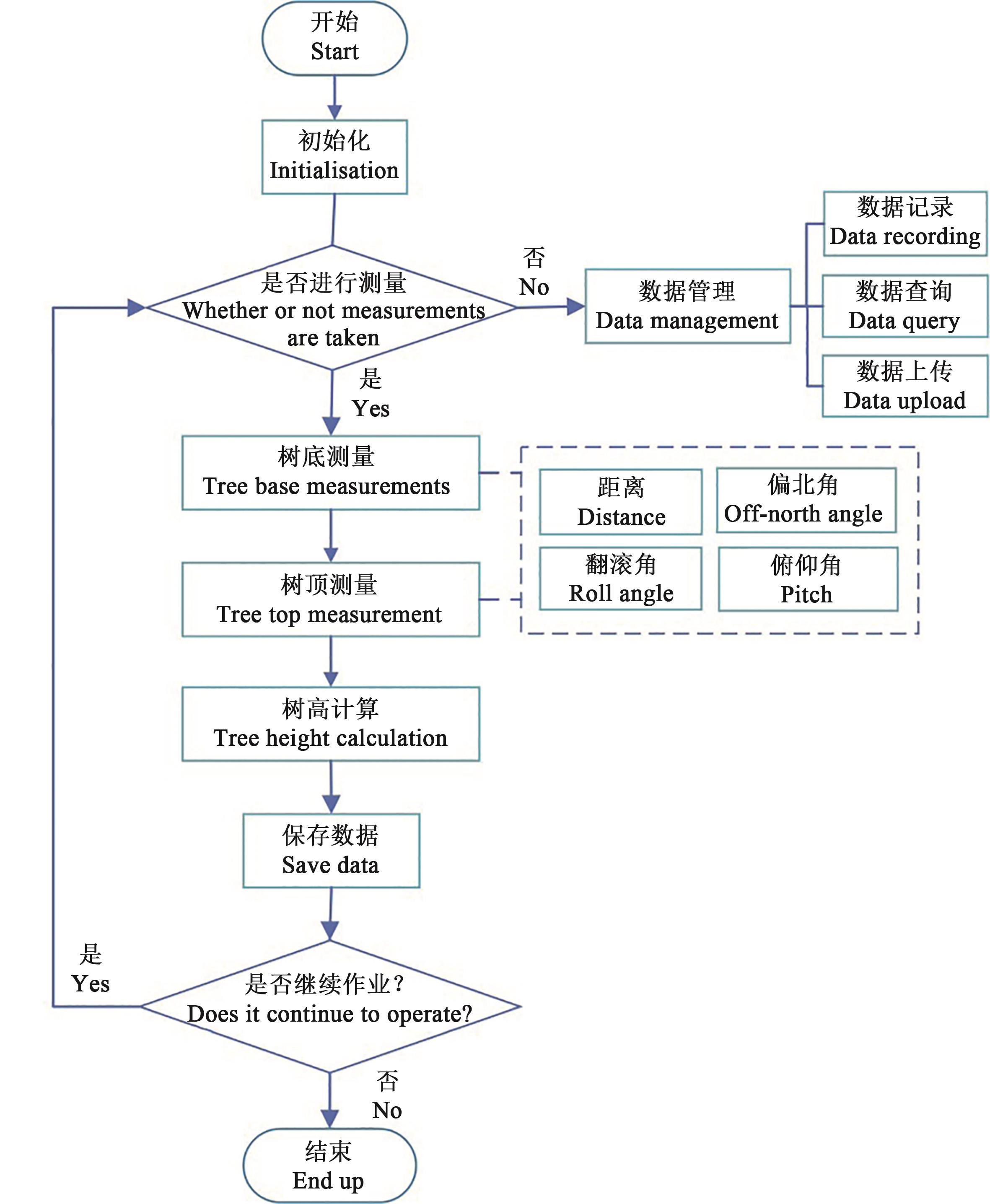
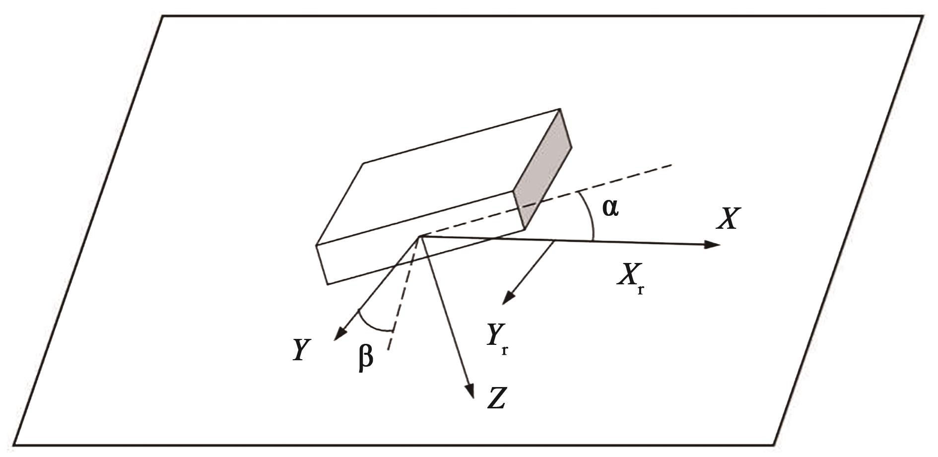
冯仲科.森林观测仪器技术与方法[M]北京:中国林业出版社,2015:2-3.
|
| 5 |
孔雷,徐伟恒,纪志芳,等.机械式电子森林罗盘仪的研究与开发[J].应用激光,2022,42(3):95-103.
|
|
KONG L, XU W H, JI Z F, et al.. Research and development of a mechanical electronic forest box compass [J]. Appl. Laser, 2022,42(3):95-103.
|
| 6 |
聂玉藻,马小军,冯仲科,等.精准林业技术的设计与实践[J].北京林业大学学报,2002(3):89-93.
|
|
NIE Y Z, MA X J, FENG Z K,et al.. Design and practice in the system of precision forestry [J]. J. Beijing For.Univ., 2002(3):89-93.
|
| 7 |
曹忠,巩奕成,冯仲科,等.电子经纬仪测量立木材积误差分析[J].农业机械学报,2015,46(1):292-298.
|
|
CAO Z, GONG Y C, FENG Z K, et al.. Error analysis on standing tree volume measurement by using electronic theodolites [J]. Trans. Chin. Soc. Agric. Mach., 2015, 46(1):292-298.
|
| 8 |
高祥,冯仲科,王智超,等.基于电子经纬仪立木无损精测技术的干形指数研究[J].农业机械学报,2015,46(1):299-305.
|
|
GAO X, FENG Z K, WANG Z C, et al.. Study on stem form index based on non-destructive precision measurement through electronic theodolite [J]. Trans. Chin. Soc. Agric. Mach., 2015,46(1):299-305.
|
| 9 |
曹忠,冯仲科,徐伟恒,等.电子经纬仪无损立木材积测量方法及精度分析[J].中南林业科技大学学报,2015,35(4):7-13.
|
|
CAO Z, FENG Z K, XU W H, et al.. Standing tree volume nondestructive measurement methods and precision analysis based on electronic theodolite [J]. J. Central South Univ. For Technol., 2015, 35(4):7-13.
|
| 10 |
何诚,张思玉,冯仲科.一种电子经纬仪立木材积精准测算方法[J].测绘通报,2014(6):116-119.
|
|
HE C, ZHANG S Y, FENG Z K.A fine estimation of standing tree volume based on electronic theodolite [J]. Bull. Surv. Map., 2014(6):116-119.
|
| 11 |
孙梦营,冯仲科,闫飞,等.电子经纬仪自动精测立木材积原理与应用[J].林业资源管理,2013(5):80-84.
|
|
SUN M Y, FENG Z K, YAN F, et al.. Principle and application of automatic accurate measurement of stem volume by using electronic theodolite [J]. Forest Resour. Manage., 2013(5):80-84.
|
| 12 |
冯仲科,姚山.全站仪量测树高方法: 101021416[P]. 中国,2007-08-22.
|
| 13 |
徐伟恒,冯仲科,苏志芳,等.手持式数字化多功能电子测树枪的研制与试验[J].农业工程学报,2013,29(3):90-99.
|
|
XU E H, FENG Z K, SU Z K, et al.. Development and experiment of handheld digitalized and multi-functional forest measurement gun [J]. Trans. Chin. Soc. Agric. Eng., 2013,29(3):90-99.
|
| 14 |
苏珏颖,冯仲科,李萍,等.手杖式测树仪立木树高量测研究[J].中南林业科技大学学报,2021,41(2):63-71.
|
|
SU J Y, FENG Z K, LI P, et al.. Study on tree height measurement based on stick-type tree measuring instrument [J]. J. Central South Uni. For. Technol., 2021, 41(2):63-71.
|
| 15 |
中国市场监督管理总局,国家标准化管理委员会. 森林资源连续清查技术规程 [S].北京:中国标准出版社,2020.
|


 ), Zhongke FENG1,2(
 京公网安备11010802021197号